Day 3 - August 23, 1999
|
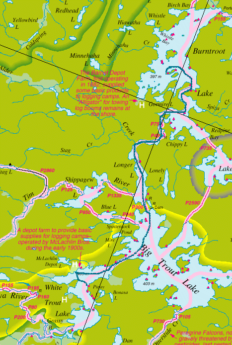
Route: White Trout L., Big Trout L., Longer L., Burntroot L.
We slept in this morning because we were tired from the previous day's travel. The bees which were buzzing about the night before caused quite a stir this morning. We finally got on the water at 10:45. |
|
|
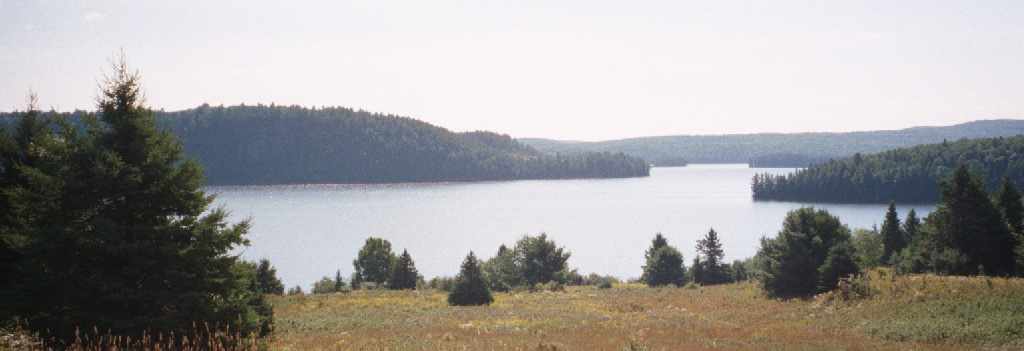
The first stop of the day was the McLachlin Depot Farm on White Trout L. We had been there on our previous trip and it was one of the high points. From a distance, the Depot Farm looks like a big grassy clearing. Once you are at the shore, you realize that the grass is up to your waist and that there are many raspberry bushes. Fortunately, several paths had been worn by animals. |

Building at McLachlin Depot
|
|
There is only evidence of one building still at the depot. Part of one wall is still standing with some of the scooped logs from the roof on top. Strangely, there is a large birch tree growing in the middle of where the building was. We walked around until we reached the top of the hill. It was a clear day and the view of White Trout L. was spectacular. Over the crest of the hill, the clearing continued for some distance. I imagine that this was a very large farming operation. |
|
View from McLachlin Depot
|
|
|
We made our way back to the canoe and headed off toward Big Trout L. at a leisurely pace. Along the way, a trio of loons popped up right next to our canoe. They took one look at us and quickly dove again. We paddled across the upper portion of Big Trout L. and portaged to Longer L. We stopped at a campsite on Longer L. for lunch. It was here that we began to realize that the cheddar cheese was not holding up too well. After lunch, I silently vowed that I would not eat any more cheese or summer sausage on this trip. As we reached the portage at the upper end of Longer L., we stopped to take a look at the rapids to see if we could run them. The water seemed high enough and neither of us wanted to say no to running the rapids. Since we had already stopped, Seth suggested that we carry our gear across the portage. He reasoned that if we didn't make the rapids, we'd feel like a couple of idiots, but at least our gear would be dry. We took one last look at the rapids and were ready to make our run. No problem! We picked up our gear and continued on our way. A short while later, we reached the next portage. The rapids here were much more wide open. Emboldened by our first run, we didn't even stop for these rapids. Once again, no problem. |
|
Sunset on Burntroot Lake
|
|
|
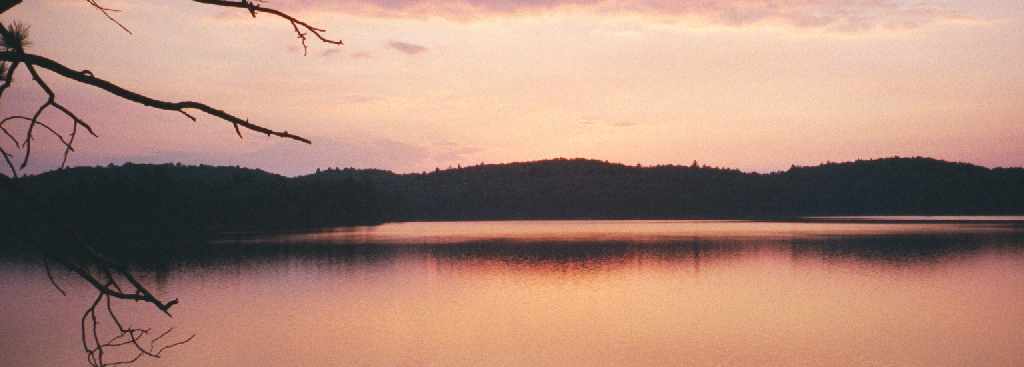
We were now on Burntroot L. and had nearly reached our trip's goal. We decided to find a campsite near the Barnet Depot Farm where the "Alligator" was located. We found a very nice campsite on the western end of an island. Although the site didn't offer much shelter from the elements, the weather did not seem to be an issue. While Seth was checking out the campsite, I felt a few raindrops as I waited in the canoe. It was the only rain of the trip. As we arrived at the campsite, a pair of mergansers were swimming around the island. At one point, Seth managed to startled them as he walked toward the shore. They returned the favor by giving Seth a start with all of their hooting. |
|
Silhouetted Shoreline on Burntroot Lake
|
|
|
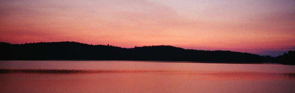
Once again, it was a very pleasant evening. We sat on the rocks while we ate our dinner and had a great view of the sunset. After dark, we looked at the nearly full moon through binoculars while lying on the rocks at the tip of the island. |
|
|
|
|